Kyoto
Ancient capital of Japan — temples, shrines, and living tradition.
Some links on this page are paid links. If you book or buy through them, J-Pedia may earn a commission at no extra cost to you. As an Amazon Associate I earn from qualifying purchases. How we make money
← Back to Japan Map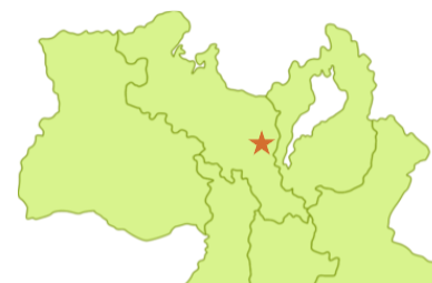
ABOUT
Japan's ancient capital for nearly 1,000 years from 794 CE. Home to numerous World Heritage sites — Kinkaku-ji, Kiyomizu-dera, Fushimi Inari — where traditions like the Gion Festival, tea ceremony, and geisha culture remain vibrant today.
WHERE TO STAY
Compare hotels, ryokan and guesthouses in Kyoto (京都) on Booking.com — free cancellation on most stays.
Search Kyoto hotels ↗THINGS TO DO
Guided tours, day trips and experiences in Kyoto, booked through GetYourGuide (free cancellation up to 24h before on most).
Browse all Kyoto experiences ↗CITY DATA
GETTING TO KYOTO
Fares are one-way estimates. If you are hopping between several cities by shinkansen, a Japan Rail Pass can come out cheaper than paying per trip — check whether the maths works for your route.
WHAT TO EAT HERE
WEATHER – KYOTO

UPCOMING
